
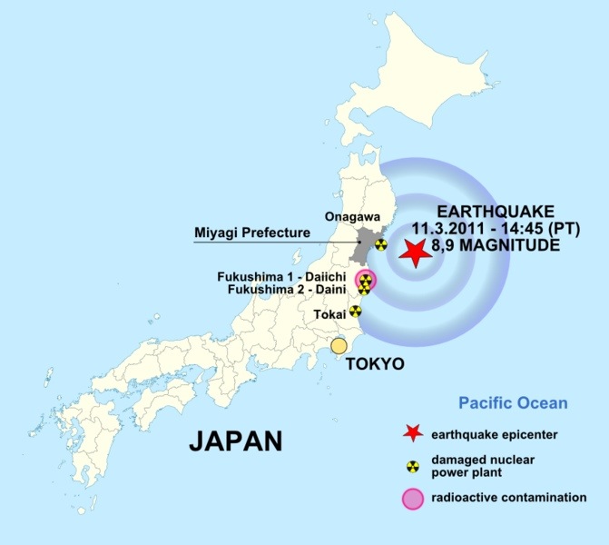
September 13-14: Tohoku
I’m currently in Japan with a group of American and Japanese geography teachers to study the ongoing reconstruction and recovery from the March 2011 earthquake, tsunami, and nuclear disasters. We spent the last two days observing the landscape and visiting schools to understand the human and environmental impacts throughout the Tohoku region in northeastern Japan.
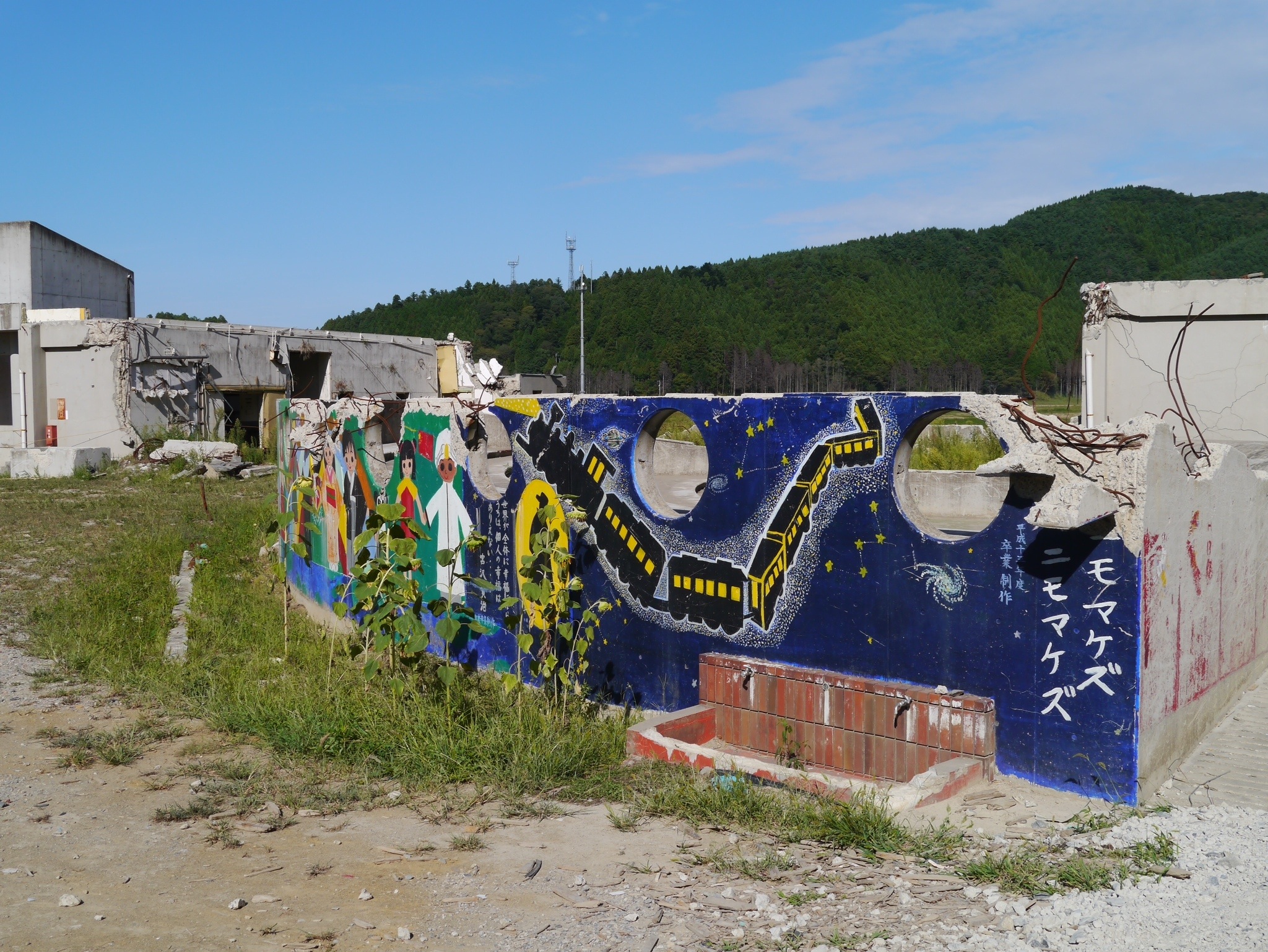
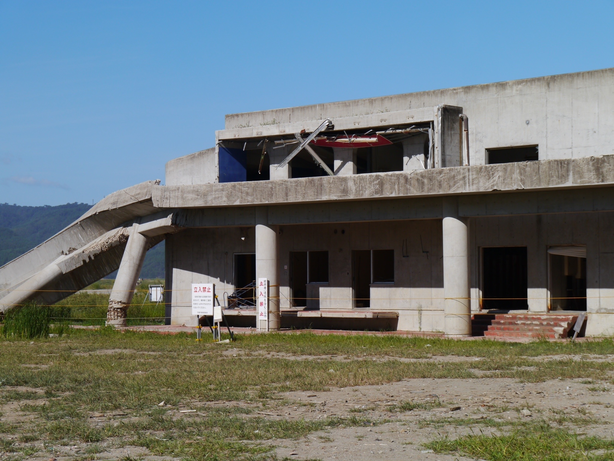
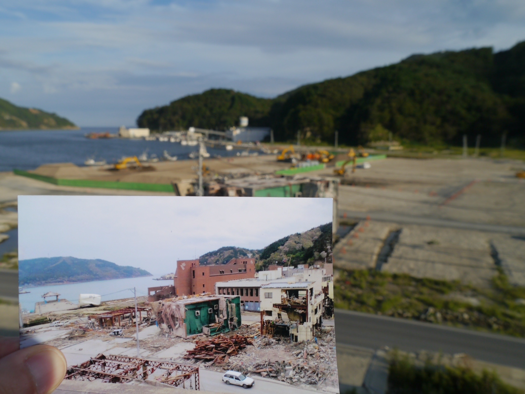
Our journey began in the city of Ishniomaki on the Sanriku Coast, a low-lying area of bountiful fishing grounds, rice fields, ports, and indented coasts. Ishniomaki was especially hard hit by the tsunami in the hours following the collosal 9.0 earthquake. Symbolic of the physical and emotional tolls affecting the area is Okawa Elementary School, located along the Kitakami River just 5km from the Pacific coast.
After the earthquake, panicked teachers and schoolchildren rushed outside to the school grounds, fearing an impending collapse of the buildings. There, they waited for information from authorities as some parents began to arrive to collect their children. No hazard map showed the school as potentially vulnerable to a tsunami, so there was little worry. And yet some teachers apparently still wondered whether they should seek shelter in the hilly woodlands adjacent to the school property. But because of snowy conditions and the possibility of landslides, the teachers decided to stay put. It was a decision that would have tragic consequences.
When the news suddenly came that a tsunami had reached the coast, the teachers began to gather the children in an attempt to move further inland. But it was too late. A tsunami rushed up the Kitakami with the force of an express train, swallowing up the school and destroying half of a bridge spanning the river. The waves crested to heights exceeding 10 meters (over 30 feet) as the waters rapidly filled the inlet surrounding the school. Seventy three schoolchildren and 10 teachers lost their lives.
Jesus … they were sitting ducks.
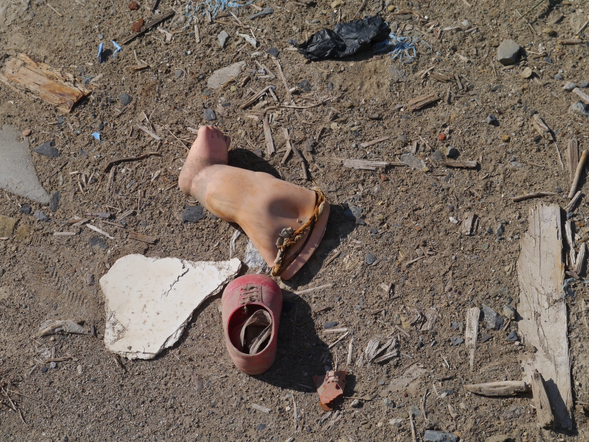
Today, Okawa’s grounds are littered with doll parts, shards of ceramic bowls, shoelaces, and other heartbreaking reminders of the deceased. Among the ruins is a hollowed-out auditorium with colorful murals evoking what once was a place filled with the sounds of children’s laughter, songs, and plays. Now the air carries the poignant cries of mourners gathered at a nearby memorial.
The hazard maps for Ishniomaki will be redrawn with somber hands.
*****
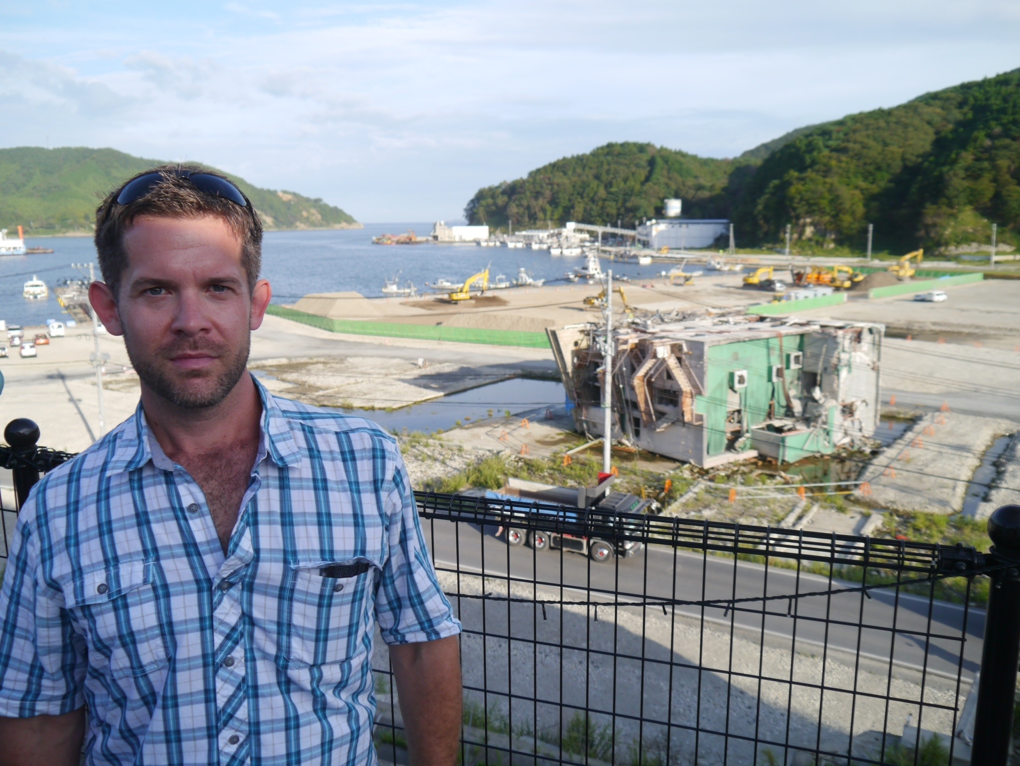
A short distance from Isnhiomaki is the port of Onagawa, where a nuclear plant was heavily damaged by a 13-meter tsunami. Yet unlike the reactors in Fukushima, the plant avoided a meltdown — but only by the slimmest of margins. The earthquake caused the plant’s foundation to sink, lowering its height to only 80 cm above the tsunami’s crest. Although the waters never spilled into the plant’s cooling chambers, Onagawa was devastated nonetheless. From a hilltop overlooking the port we observed an army of tractors and bulldozers paving over a landscape dotted with towering mounds of wrecked vehicles and overturned steel and concrete buildings. It’s almost impossible to comprehend how this very spot once supported a vibrant fishing community.
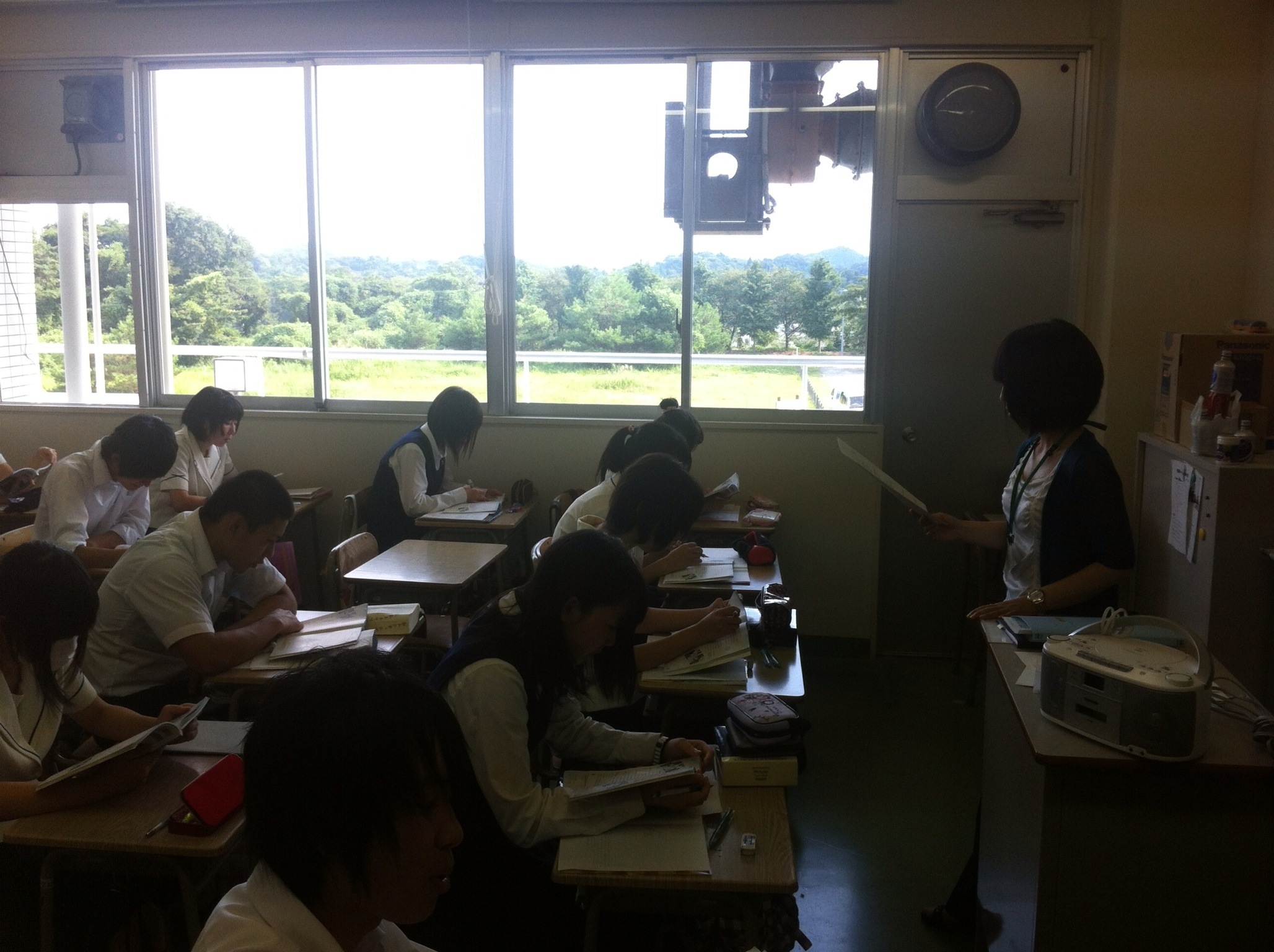
We concluded our field study in Iwaki, a city 50 km south of Fukushima. The Japanese government continues to enforce a no-go zone within a radius of 20 km of the reactors. The zone includes the rural campus of Futaba high school, which now operates in a satellite location in Iwaki.
Futaba’s principal showed us a video of workers cloaked in protective gear taking radiation measurements and salvaging what they could from Futaba’s shattered classrooms and labs. He related stories of the hard sacrifices made by Futaba teachers to create positive learning environments for students, many of whom are still recovering emotionally from the shock of the event as they transition to life in an unfamiliar city. Despite their continued struggles, the school staff greeted us with engaging smiles and students who were eager to pose for group photos, show off their physics experiments, and kick around soccer balls on the athletic field.
In the coming days, the American teacher delegation will work with their Japanese colleagues to create geographical case studies of the disasters. Their work will be published later this year on the website of the AAG Center for Global Geography Education, a project which uses Internet technologies to link schools and colleges worldwide for collaborative learning projects. It will be difficult for these teaches to convey the power of what we observed firsthand in Tohoku, but I have full confidence in their ability to do so.
*****
I’m often asked by the people I meet, “What do you do?” I hope this post provides an answer to that question, but also to a more interesting one:
Why?
After recurrent doubts over the last year or two, I’d like to thank the courageous people of Tohoku for the reminder.
